The legendary barrier islands are ideal for long walks on the beach. But if you search a bit further, you will find a diverse network of public paths and nature trails waiting to be explored. This essay shares some of the most accessible and rewarding hikes on Roanoke and Bodie Islands from Oregon Inlet to Duck - navigating boardwalks, estuaries, maritime forests, and cozy communities to include natural, cultural, and historic landmarks. Please enjoy Benjamin Lashley’s lovely photography, read the insights, and view the routes on The OBX Hiking Map.
1. Owens’ Welcome - Boardwalk - Easy - .50 mi One-Way
Begin your visit to the Outer Banks with a scenic saunter to the Croatan Sound. Immerse yourself in the fringe of the maritime forest and reflect on your journey to paradise. Public parking, restrooms, and water are always available at the Welcome Center where you can learn more about local paths, including the nearby Collins Trail which features important interpretive signage. The recently renovated woodwork is excellent for all ages and abilities.
2. The Freedom Trail - Straw and Sand - Easy - 1.25 mi One-Way
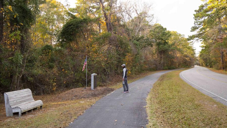
This significant historic path connects the Croatan Sound to Fort Raleigh, lined with silhouettes of liberated slaves, leading to the First Light of Freedom Memorial. The black stone monument recognizes the NC Civil War Heritage Trail and National Underground Railroad Network. You may time your return hike to the Freedmen’s Point lot for sunset over Manns Harbor, but please stay alert for snakes near water and cars when crossing internal roads.
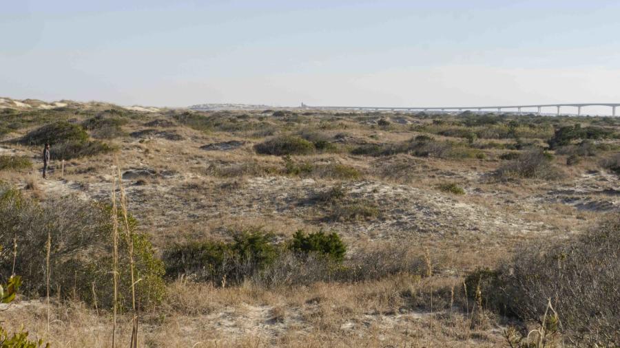
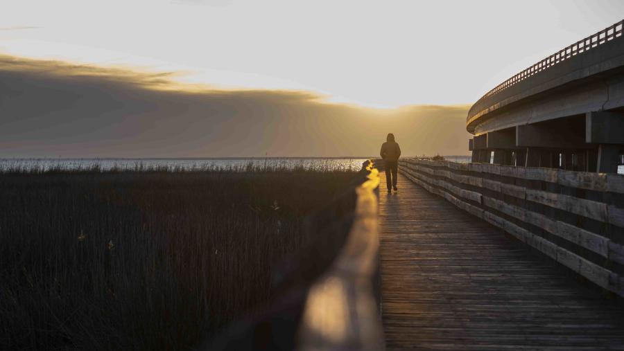
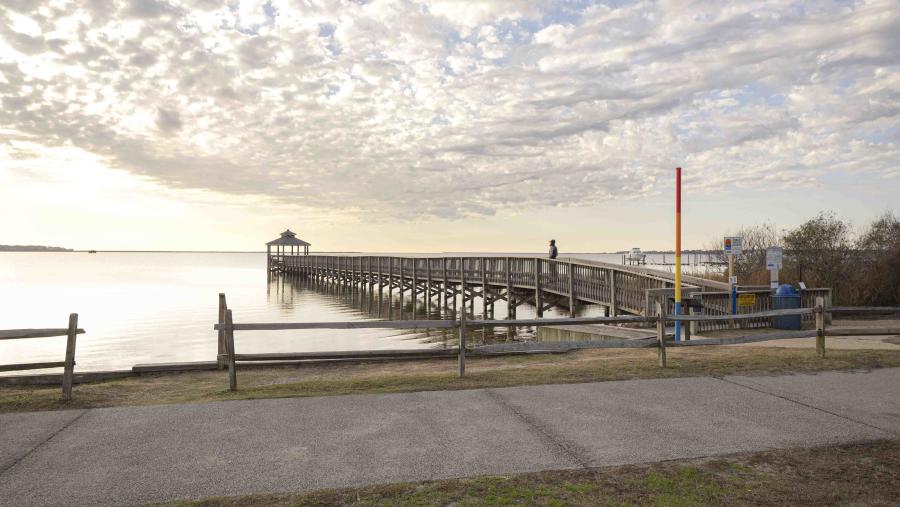
3. New Oregon Inlet - Ocean Sand - Strenuous - 2.10 mi One-Way
Witness the relentless power of the Atlantic as it ebbs and flows through the Pamlico Sound. There is no protection from sun, wind, rain, sand, or waves, so dress appropriately, stay visible, and check tide cycles. This route is seasonally closed for nesting birds, but when open, passes under the 3 mi Basnight Bridge to a view of Bodie Island Light. Public parking and a porta are available at ORV Ramp 4, marked by THE OBX WAY Adopt-A-Beach sign.
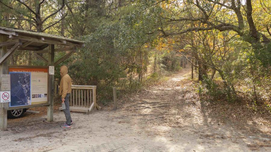
4. Old Nags Head - Sand and Gravel - Moderate - 2.4 mi One-Way
This year-round route features maritime forest dunes extending from Jockey’s Ridge. The trees provide relief from the summer sun and winter wind, but cannot help with flying insects or ticks. Water and restrooms are located at both the Town Park and Nature Conservancy office. While leashed dogs are allowed on the Town Trail, bikes are not. Please be aware that Old Nags Head Woods Road is open to vehicles, so please stay alert.

5. Kill Devil Hills - Multi-Use Path - Moderate - 1.50 mi One-Way
This flat, paved path is packed with cultural charms and historic landmarks. Beginning at KDH Town Hall, a colorful winged-horse represents the modern artistic aesthetic, while the nearby Baum Center features the timeless Outer Banks totem. Observe the Veterans and Wright Brothers Memorials before passing the First Flight airstrip en route to Colington. Carry cash for a tavern pit-stop and delight in the crabbing community artifacts.
6. Kitty Hawk Bay - Multi-Use Path - Moderate - 2.00 mi One-Way
This is a popular residential path for dog walkers, runners, cyclists, and e-bikers, with multiple sheltered access sites. This route is also a vital alternative to walking or running on the ocean “Beach Road” with reduced and slower traffic. However, the area does not currently have public water or restrooms, so plan accordingly. Hug the guardrail near Windgrass Circle Park, which serves as the trailhead for the .35 mi Wright Brothers Path.
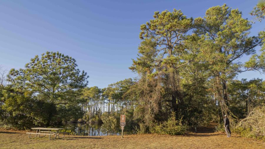
7. The Woods Road - Multi-Use Path - Easy - 1.65 mi One-Way
This serene tree-lined path may remind mountain hikers of the Blue Ridge Parkway, with hidden landmarks instead of majestic overlooks. Route spurs lead to a creek mural, a community cemetery, a covered bridge, and an abandoned railroad bed. Please respect private property along the 35-mph road, and enjoy Sandy Run Park with its accessible boardwalk loop around Duck Pond Creek. Both endpoints have public parking and portas.
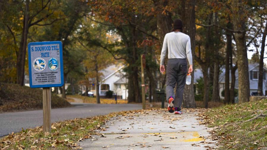
8. Southern Shores - Residential - Moderate - 4.60 mi Loop
Dogwood Trail is a public path that runs between Jean Guite (Ginguite) Creek and Duck Woods Country Club. This paved and shaded sidewalk is an opportunity to view the charming, quiet community, otherwise requiring a parking permit. A small grove separates Fairway and Duck Woods Drives, marking the half-way point with Callie’s Bench as a place to rest and reflect. This nostalgic walk-around-the-block features a sunset view on return.
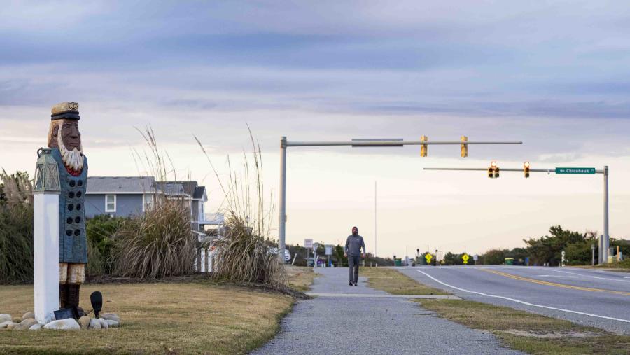
9. Chicahauk Dune - Residential - Moderate - 3.25 mi Loop
If you rise with the Atlantic sun, this route is for you. Tour past traditional beach box cottages on NC 12 before veering into the secluded, sylvan neighborhood. The internal sidewalk lays under mature tree canopies, before crossing a creek, and reconnecting with “The Bypass.” Public parking without a permit is only allowed at the Southern Shores Municipal Complex, while a visit to the Aycock Brown Welcome Center is highly recommended.
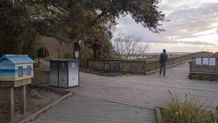
10. The Duck Boardwalk - Multi-Surface - Easy - 3.25 mi Loop
This wooden wonder sprawls for nearly a mile along the Currituck Sound with the Carolina blue water tower serving as a point of reference. The Duck Trail multi-use path and new living shoreline to the N is shared by local commuters and guests getting their vacation workout. This open-air route extends past the Army Corps of Engineers’ 140 ft observation tower, to the Duck Fire Department, near the former site of Caffey’s Inlet.
This project was made possible by a grant from the Outer Banks Community Foundation and Dare County Schools “Careers Beyond the Counter” HONORS course program. As part of his 2-year internship, student-photographer Benjamin Lashley, provided distinctive photos for this essay as well as the “Outer Banks Bicycle Routes” and “Outer Banks Paddle Trails” essays. Additionally, Ben won the 2024 NC Wildlife youth photo contest. His award winning image, Pocosin Paradox is proudly displayed in the atrium of the Sarah Owens Welcome Center.
Author - THE OBX WAY
THE OBX WAY is a 501(c)(3) nonprofit, founded and directed by Luke Halton to research, document, and promote public hike, bike, and kayak trails on the Outer Banks for the purpose of safety, health, and education. THE OBX WAY partners with other community organizations to improve outdoor recreation access and inclusion, while supporting the principles of the Outer Banks Promise and Indigenous Earth Ethic to encourage responsible environmental stewardship.