THE OBX WAY researched public paddle access from Duck to Oregon Inlet and created ten Outer Banks blueway routes for the purpose of safety, health, and education. The routes provide opportunities for beginner, intermediate, and advanced paddlers to explore remote maritime ecosystems through canals, creeks, and bays with an interactive Google Map. They partnered with Dare County Schools’ Careers Beyond the Counter HONORS course intern Benjamin Lashley to archive launch sites and share his acclaimed outdoor photography. Please enjoy Ben’s photos, and notice the local water safety insights, before viewing the map.
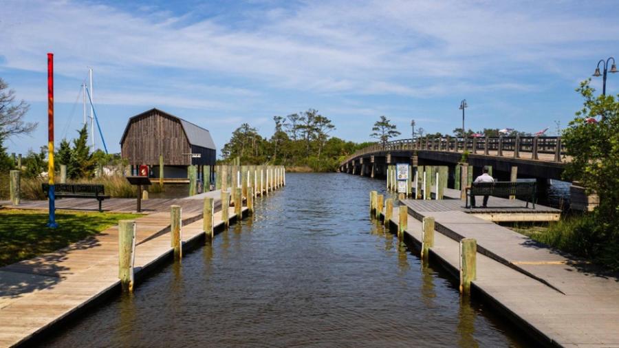
Travel S under the Cora Mae Bridge, past the Elizabeth II, Waterfront Marina, and Marshes Lighthouse. Give way to larger vessels and hug the boardwalk to Scarboro Creek. Half-way to Ballast Point at the N end of Pirate’s Cove, a secluded beach on state land is an ideal rest area. Observe Shallowbag Bay conditions and traffic while planning your return. Also, duck blinds are licensed by the county and maintained by the hunters. Please respect their property.
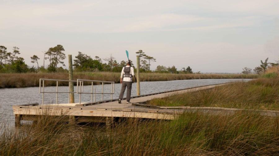
The floating dock launch on the NW edge of Roanoke Island Festival Park or “Bluegrass Island'' taps into a canal grid that connects to the sound. Reach Baum Point and continue NW past the private docks to the half-mile sandbar, also known as Banana Island. This is a popular playland for boaters in the summer, who anchor on the beachhead. Mayberry gossip is Andy Griffith, whose house overlooks the strip, barged the white sand in from the Caribbean.
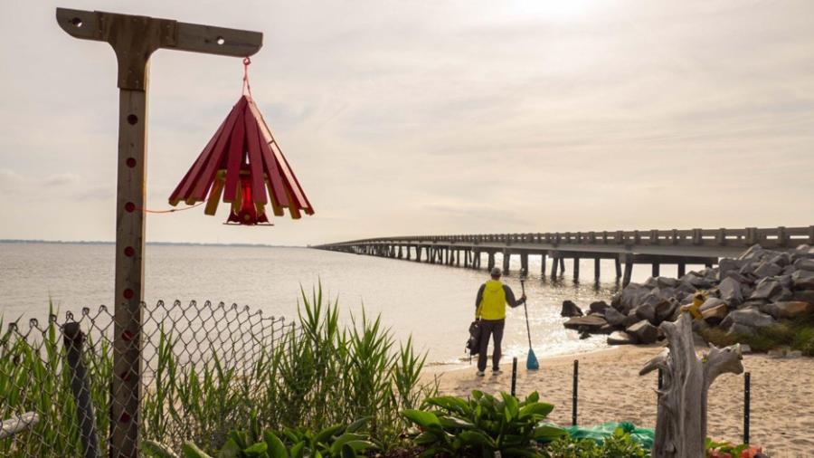
3. Pineapple Beach - NW Roanoke Island - Advanced - 1.25 mi
A volunteer couple reclaimed the site in 2021 by removing over 3 tons of trash and installing art, gardens, and bird baths. This highly exposed route passes neighborhood jetties before curving NE towards Etheridge Point. Use caution when navigating the jagged remnants of devastated docks, especially closer to shore, where breakers abruptly shove. Dough Cemetery, at the NPS lot, is a profound platform to vista gaze from Point Harbor to Jockey’s Ridge.
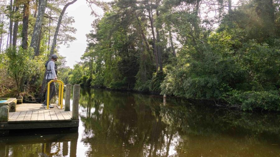
4. Bowsertown Ditch - W Roanoke Island - Intermediate - 1.88 mi
NCDOT repairs to the boardwalk at Owens Welcome Center will enable another generation to overlook the dynamic Croatan Sound as it flows under the 5-mile Virginia Dare Memorial Bridge. However, to reach the new parking lot dock from the waterway, the basin water under the VDMB must be high enough to fill the field channel. Use the satellite layer in Google Maps and your live GPS location to confidently navigate the maze of creeks back to Bowsertown.
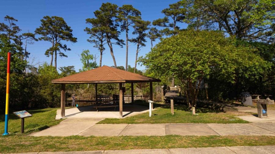
This maritime forest pond is an ideal training ground for someone with little to no experience. Specifically, the launch is close to the parking area, the trees provide wind protection, and the creek is wide enough to practice paddle techniques. The boardwalk and kiosk map also allow for a preview of the entire watercourse. Additionally, the well-shaded reserve has a drinking fountain, portas, and shelter. Please be mindful of recreational fishing lines.
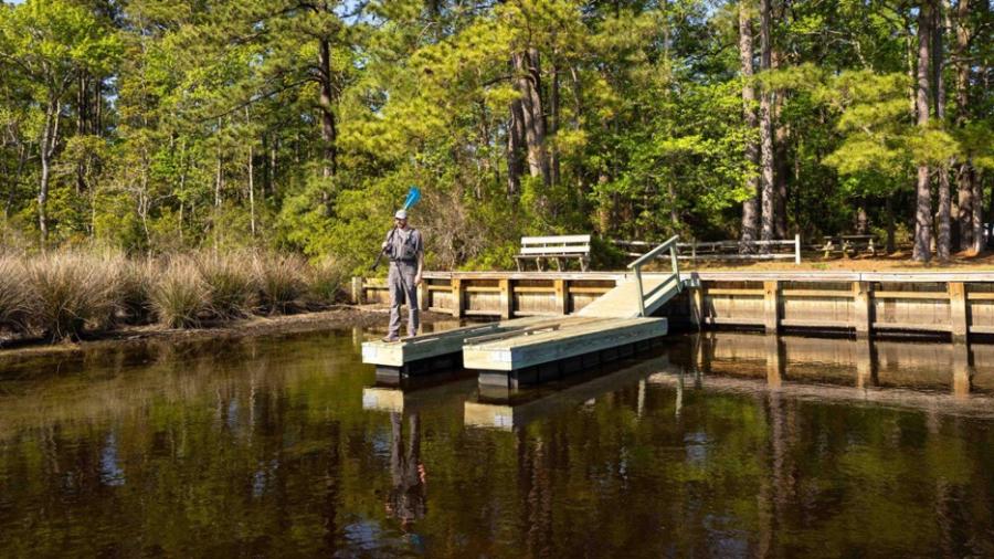
6. Bob Perry Boat Ramp - Jean Guite Creek - Intermediate - 2.20 mi
This access is regularly used by seasonal guides for tours N on “Ginguite Creek” to the vibrant underpass mural and rustic covered bridge. Alternatively, our scenic S route provides a bit more exploration, winding through an atoll, before reaching a mini-cape on state land. Fortunately, this launch has ample parking, extra portas, and shaded tables. Importantly, this blueway gives paddlers experience near Kitty Hawk Bay and the Roanoke Sound.
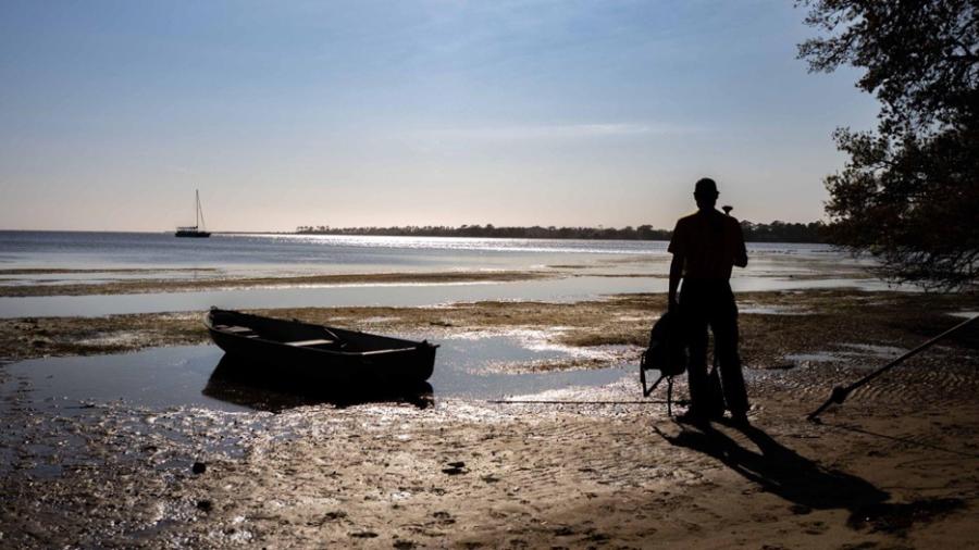
7. Windgrass Circle - Kitty Hawk Bay - Beginner - 1.61 mi
Paddlers can preview the cove by strolling N on the Wright Brothers Multi-Use Path to Moor(e) Shore Road. In 1900, Orville and Wilbur used this passage to commute from their Kitty Hawk digs to Kill Devil Hills jobsite. In 2019, a living shoreline was installed to prevent road erosion while protecting the sensitive wetlands. This natural harbor’s firm shoals, shoreline visibility, and minimal traffic create a novice training haven to develop skills or test new equipment.
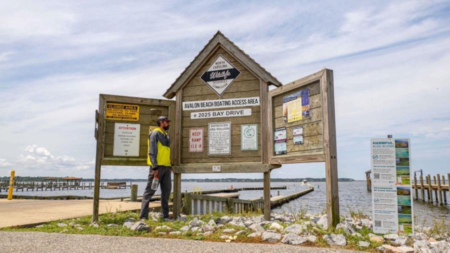
8. NC Wildlife Avalon Beach - Colington Creek - Intermediate - 1.61 mi
Unload at the ramp, but park in the gravel lot across Bay Drive. The spots in the main, paved lot are reserved for vehicles with trailers. Travel S past residential boardwalks, the 3rd Street gazebo, and stay E of the archipelago or you may unintentionally run aground in the shallow straits between the slough islands. The muck in this area is extra-soft, and if you get stuck while stepping out, no one can see or hear you… even from the legendary Blue Crab.
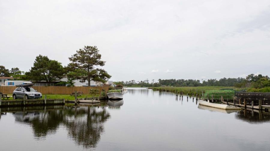
9. Joe & Kay’s Campground - Buzzard Bay - Intermediate - 2.05 mi
Joe & Kay’s is THE ONE tent campground on the Outer Banks, N of Oregon Inlet. This cultural touchstone also allows guests to use their private put-in to travel S on Colington Creek, along Run Hill State Natural Area, to the beach terminus of Roanoke Trail. This hiking path also features a mobile audio guide to Tillett Cemetery. Less than .25 miles away on Ocean Acres Drive, the Nature Conservancy office has local trail maps, new signage, water, and a porta.
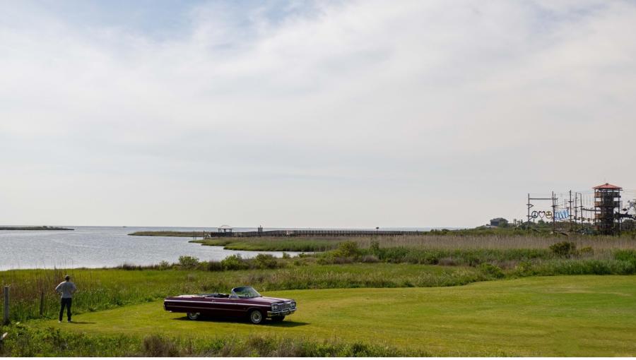
10. Harvey Public Access - Roanoke Sound - Advanced - 3.11 mi
This route is only recommended under ideal conditions. With wind <5 mph and a gentle current, the Nags Head sound surface resembles a pond. These are the rare days to attempt this trek. Travel N past the Adventure Park tower, golf course bulkheads, and Cove Association piers to Jockey’s Ridge SoundSide Access. This strip is also popular with kiteboarders and windsurfers. If conditions worsen mid-trip, please consider the 1-hour walk back to your parked car.
Safety Message
The Outer Banks is known as “The Graveyard of the Atlantic.” But minutes from the ocean, soundside marshlands provide mystic portals to nature, wildlife, and history. However, aquatic adventures require enhanced safety awareness. Rivers run from the NW into the sounds, which flood and ebb through the inlet, creating treacherous currents. The estuarine waters also rise with recent rain, flowing tides, and directional wind… The wind cannot be underestimated. Do not attempt to paddle in sustained speed >15 mph or 13 kts, and know the forecasted gusts.
Specific Insights
- Tell someone where you’re launching from, your route, and when you expect to return.
- Always wear a Personal Floatation Device (PFD), especially when moored in the wild.
- When making a rest-stop, best practice is to pull your craft from the water AND tie-up.
- Test ground stability before stepping out. Muck appears firm, but can be waist-deep.
- Assume you will walk in at least knee-deep water. Wear shoes to protect your soles.
- Wear glasses for eye protection near brush and cordgrass, which is sharply pointed.
- Always carry drinkable water, a marine whistle, and a sailor’s knife for cutting snags.
- Dare County has over 500 duck blinds. Be extra-visible if out during hunting season.
- These routes are designed by THE OBX WAY to be in sight of civilization, stay close.
- If paddle conditions are rough, consider experiencing our many archived hiking paths.
THE OBX WAY was outfitted by OBX on the Fly with an electric kayak for harsh-condition research, after months of planning and preparation. Navigation experience may differ for SUP and canoe paddlers. This project was made possible by a generous grant from the Outer Banks Community Foundation and is only intended for self-guided and non-commercial use. Always enjoy, but please be safe and leave no trace.

