-
The Huron
The Huron is located close to the Bladen Street beach access in the Nags Head area near Milepost 11/12. This is one of the more known beach dives that you can visit on the Outer Banks as it lies to the north of Nags Head Fishing Pier. Approximately 200 yards offshore, during the summer months it’s usually marked by buoys, making it easy to find. On clear days, divers and swimmers can explore the shipwreck that lies at a depth of about 20 feet of water. Traveling from bow to stern, snorkelers can see cannonball storage racks, the propeller and rudder, and also the boiler. The ship is surrounded by a variety of sea life and shifting sands that cover and uncover portions periodically.
The Huron sank on November 24, 1877, on her first night out to sea while heading to Havana, Cuba. Heavy winds, rain and a faulty compass caused The Huron to run aground. Along with her two sister ships, The Huron was the last naval vessel in America to be built from iron (instead of steel) and also equipped with sails for supporting the large steam engines onboard.
-
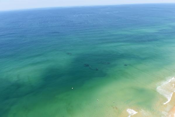
"The Triangle Wrecks"
"The Triangle Wrecks" are located close to the Second St. beach access in the Kill Devil Hills area near Milepost 7. Two ships had the misfortune of running ashore in the same location but two years apart. December of 1927 marked the sinking of the first ship, The Kyzickes. The Kyzickes was a tanker bound for Spain with a cargo full of crude oil when it was caught in a storm. The strong winds caused the ship to take on water, ultimately destroying the boiler tubes. In 1929, the vessel Carl Gerhard also managed to run aground at the exact same location, slicing through the remains of The Kyzickes. Below the water line, you can see wreckage including a boiler. The wreckage takes the shape of a “triangle” and lies in about 15-20 feet of water. The scattered chunks of both wrecks can be found starting at 100 yards and ranging to 250 yards offshore.
-
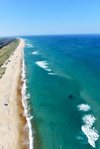
The Oriental
The Oriental shipwreck is located three miles south of the new Basnight Bridge over Oregon Inlet, directly across from Pea Island Visitor Center. Also known as “The Boiler Wreck,” The Oriental’s steam engine protrudes from the water and resembles a boiler about 100 yards from shore in 15-20 feet of water (depending on tides) and is surrounded by strong currents. The wreck is perpendicular to the beach with the bow pointing towards the shore. This 210’ federal transport taker sank on May 16, 1862, and can oftentimes be seen with small boats in its proximity dropping a fishing line, so a dive flag is strongly recommended.
-
The Pocahontas
As we move south of the Northern Beaches into Hatteras Island, you will find The Pocahontas. Located off Sand Street in Salvo, this wreck has sometimes been called “The Richmond.” This wreck can easily be accessed by taking Ramp 23 and driving north until you see the paddle-wheel shaft emerging from the water. Tip: During the summer months, the National Park Service may close the beach for driving, but walking is permitted. Wreckage of The Pocahontas is just 75 yards out in waters ranging from 10-15 feet in depth. This paddle-wheel steamer was lost during the Civil War during the Burnside Expedition before the "Battle for Roanoke Island."
-
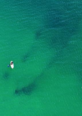
"The Winks Wreck"
"The Winks Wreck" is located near Milepost 2 in the Kitty Hawk area just off Luke Street. It sits in about 15-20 feet of water approximately 120 yards off the shore. The locals named this "The Winks Wreck" as it is close to the Winks Store located just off the beach road at Eckner St. The Winks Wreck site is not very large, making it slightly more difficult to find than other wrecks. Timing high tide and water visibility levels will be key in identifying this vessel. The history of the ship is still not officially confirmed, however some believe it could be the British Steamer Mountainer from Liverpool.
Roanoke Island Outfitters/Dive Center and Dive Hatteras are additional sources for diving and equipment rentals on the Outer Banks.